
- Glacier Point Road is a beautiful scenic drive to a marvelous overlook
- This drive is located in Yosemite National Park south of Yosemite Valley
- Stop at Mono Meadow for a challenging hiking excursion
- In the winter, enjoy cross-country skiing to Glacier Point
- Hike from Glacier Point to Yosemite Valley
Overview
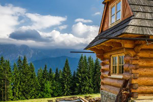
Glacier Point Road offers the Yosemite visitor not only stunning views of Yosemite Valley from Glacier Point, but provides access to amazing hiking trails, sub-alpine meadows alive with wildflowers and premiere winter sports.
Driving Directions
Starting from Yosemite Valley, you can reach Glacier Point Road by taking the Wawona Road south and turning left at the Chinquapin junction. Glacier Point Road is only accessible from late May or early June to sometime in November. The drive takes you to the end at Glacier Point.
Distance
From the intersection with Wawona Road, Glacier Point Road is a 16-mile drive to the end, taking around 30 to 40 minutes.
Highlights
- Badger Pass Ski Area
After turning onto Glacier Point Road, you’ll soon come to the famous Badger Pass Ski Area. Only open in winter, this is where snow lovers come to experience great skiing, both downhill and cross-country. When coming in the winter, you can still access Glacier Point, but only by skis or snowshoes. - McGurk Meadow Trail Hiking
Starting just west of the Bridalveil Creek Campground, the McGurk Meadow Trailhead takes you on a 4-mile roundtrip hike to Bridalveil Creek, or further (7 miles roundtrip) to Dewey Point. This moderate trail is a pleasure in spring with the wildflowers blooming in the meadows. - Ostrander Lake
Hike to this lovely mountain lake on a 12.7-mile out-and-back trek. Plan on taking about 8 to 10 hours for this scenic hike through forests and meadows. - Mono Meadow Hike
If you want to take a challenging hike, start at the Mono Meadow parking area and descend to the meadow, following this 3-mile roundtrip trail to view Mount Starr King, the Clark Range and Half Dome. - Sentinel Dome and Taft Point Hike
This moderate 2.2-mile hike begins at Taft Point Trailhead and moves through the gorgeous meadows and forests. From Taft Point you’ll get spectacular views of the Yosemite Valley. Continue to Sentinel Dome, where once at the top, you will have a breathtaking 360-degree panorama. - Glacier Point
At an elevation of 7,214 feet, this overlook offers the type of views normally only enjoyed by the birds soaring above the rock formations. You’ll easily spot Half Dome, and can spot Yosemite Falls, Vernal Fall and Cloud’s Rest. There are a few hiking trails that start from Glacier Point. You can even hike all the way to Yosemite Valley.


